|
|
|
|
|
|
|
|
|
|
|
|
|
|
|
|
|
|
|
|
|
|
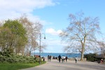
Da Lat - at night |
October 26th, 2013 |
View Da Lat by Night in a larger map
|
 On this Saturday afternoon I flew from Ho Chi Minh City to Da Lat in the central highlnds of vietnam. It was just a 45 minutes flight but it was amazing to experience the temperature difference: at least about 10C!. After I checked into the Dreans hotel the next I noticed that it was turning dark even before 6 pm so my first walk to explore my new surroundings was in the dark. As I had no idea where to go and how to get back I used GPS tracking with Endomondo on my iPhone to find my way around and back. During the walk I had dinner on the market in Nguyen Thi Minh Kai. On this Saturday afternoon I flew from Ho Chi Minh City to Da Lat in the central highlnds of vietnam. It was just a 45 minutes flight but it was amazing to experience the temperature difference: at least about 10C!. After I checked into the Dreans hotel the next I noticed that it was turning dark even before 6 pm so my first walk to explore my new surroundings was in the dark. As I had no idea where to go and how to get back I used GPS tracking with Endomondo on my iPhone to find my way around and back. During the walk I had dinner on the market in Nguyen Thi Minh Kai.
|

|
View today's pictures of the walk in Da Lat.
|
|
Duxton Hotel Saigon to SGS Building |
October 22nd, 2013 |

 When I am traveling and working abroad I like to experience the local way of traffic and if the office is not to far from the hotel it means that I like to walk from the hotel to the office in the morning and back in the evening. In other cases I would travel by bus or underground. In Ho Chi Minh City the distance was only just over 2 kilometres so on my second day in town I started to walk to the office and enjoy streetlife as I try to show by the pictures. I have to admit that this first day I did take the wrong exit from the park Cong Vien Tao Dan.
|

|
As I had not taken the direct route between the hotel and office in the end the walk was almost 5 kilometres.
But off course I did not mind: it gave me a great view of the streetife.
View Duxton Saigon to SGS in a larger map
|
View the pictures of the walk Duxton Hotel Saigon to SGS Building in today's album.
|
|
|
|
|
|
Walk in Subic Bay Freeport Zone
|
October 13th, 2013 |
 After a drive of just over 2.5 hours from Manila, by company car and driver, I arrived in the Court Meridian hotel in Subic Bay Freeport Zone just around 4 PM on this Sunday afternoon and decided to go for a walk starting on the beach across the road in front of the hotel. After a drive of just over 2.5 hours from Manila, by company car and driver, I arrived in the Court Meridian hotel in Subic Bay Freeport Zone just around 4 PM on this Sunday afternoon and decided to go for a walk starting on the beach across the road in front of the hotel.
 It was good to strech my legs after the drive and to feel the heat from the sun instead of the airco's in the hotel and car. Although this area must see a whole lot of foreigners I was surprised by the attention I got from the local people I met and not only from the souvenir vendors. Most people greeted me with ´Good afternoon sir!´. It was good to strech my legs after the drive and to feel the heat from the sun instead of the airco's in the hotel and car. Although this area must see a whole lot of foreigners I was surprised by the attention I got from the local people I met and not only from the souvenir vendors. Most people greeted me with ´Good afternoon sir!´.
 Subic Bay is known as the big military base during the Vietnam war and the American influence is seen in the infrastructure and the restaurants (and bars): Steakhouses and Pizza´s. Although I did not bring my ID with me I left the Freeport Zone via the footbridge over the river and walke a bit over the mainroad in a northerly direction to get a better view of the bay. Subic Bay is known as the big military base during the Vietnam war and the American influence is seen in the infrastructure and the restaurants (and bars): Steakhouses and Pizza´s. Although I did not bring my ID with me I left the Freeport Zone via the footbridge over the river and walke a bit over the mainroad in a northerly direction to get a better view of the bay.
View all pictures of my Subic Bay Freeport Zone walk.
|
|
Hiking with different people
|
September 14th, 28th and October 5th, 2013 |
After completing the 4-day hikes in Alkmaar at the end of June the regular weekend hikes with my sister are over.  As I still enjoy the hiking after working at home the whole week I signed up with a website where people organize all kinds of group activities including hiking. As I still enjoy the hiking after working at home the whole week I signed up with a website where people organize all kinds of group activities including hiking.
Right after my stay in Milan I joined a group on September 14th to explore the Western Islands just outside the inner city Amsterdam. The hike was organized by a person with a long experience as a tour guide. I have not remembered all his stories but it was nice to hear about the history and all the activity that used to be on these islands when  Amsterdam was growing and expanding. Amsterdam was growing and expanding.
On Saturday September 2th I joined a hike that started from the Diemen train station and took us over the island IJburg, a new part of Amsterdam with new houses to the former sea dike and on to Muiden. After a relaxing rest near the locks in the river Vecht and a short view of the Muiden castle we continued to Weesp where we could take the train again.
 On October 5th I met quite a large group at Castricum train station for a hike into the forests, sand dunes and North Sea beach west of Castricum. The weather as well as the hike were very enjoyable and so were the people I met (again). For me this is really a nice way to spend a day in the weekend and although I have nice travels coming up the next 6 weeks I will miss these hikes around my own country. On October 5th I met quite a large group at Castricum train station for a hike into the forests, sand dunes and North Sea beach west of Castricum. The weather as well as the hike were very enjoyable and so were the people I met (again). For me this is really a nice way to spend a day in the weekend and although I have nice travels coming up the next 6 weeks I will miss these hikes around my own country.
View all pictures of September 14th.
View all pictures of September 28th.
View all pictures of October 5th.
|
|
Sunday afternoon in Milan
|
September 8th, 2013 |
 As I had to work a week in Milan I decided to take a flight a day earlier and discover a bit of the city by walking around on a lovely Sunday afternoon. After dropping my bag at the hotel the first goal was the Duomo and the shopping area where the major fashion brands can be found. As I had to work a week in Milan I decided to take a flight a day earlier and discover a bit of the city by walking around on a lovely Sunday afternoon. After dropping my bag at the hotel the first goal was the Duomo and the shopping area where the major fashion brands can be found.
 On of the first things that surprised me about the street views was that many of the electric trams in the street appeared old to me: in my hometown The Hague you find those in the public transport museum and you can rent them for parties to move your guests around the city. I must say that I did like the idea of these old trams still in use much more. On of the first things that surprised me about the street views was that many of the electric trams in the street appeared old to me: in my hometown The Hague you find those in the public transport museum and you can rent them for parties to move your guests around the city. I must say that I did like the idea of these old trams still in use much more.
 The Duomo is impressive from the outside but I did not bother to queue up for a visit inside. The Galleria Vittorio Emanuele II mall is nice as well and probably a must see in the city. From the Duomo I walked to the Castello Sforzesco, the remains of the old inner city castle. Not knowing much of the Italian history and Italy in general I was surprised by the big castle in the middle of the city and the nice park next to it. From the park I found my way back to the hotel again to refresh and prepare for my first Italian dinner of the week. The Duomo is impressive from the outside but I did not bother to queue up for a visit inside. The Galleria Vittorio Emanuele II mall is nice as well and probably a must see in the city. From the Duomo I walked to the Castello Sforzesco, the remains of the old inner city castle. Not knowing much of the Italian history and Italy in general I was surprised by the big castle in the middle of the city and the nice park next to it. From the park I found my way back to the hotel again to refresh and prepare for my first Italian dinner of the week.
View all pictures of my Sunday afternoon walk in Milan.
|
|
Hiking on Ameland
|
August 24th and 25th, 2013 |
 Ameland is one of the islands north of The Netherlands and after a ong train and bus ride from The Hague I arrived at the boat ferry in Holwerd around 11:30 AM on Saturday morning. A perfect day for hiking: blue skies, cool breeze and and not too warm. The boattrip to the village of Nes at the island takes about 45 minutes and after droppingh my Ameland is one of the islands north of The Netherlands and after a ong train and bus ride from The Hague I arrived at the boat ferry in Holwerd around 11:30 AM on Saturday morning. A perfect day for hiking: blue skies, cool breeze and and not too warm. The boattrip to the village of Nes at the island takes about 45 minutes and after droppingh my
 overnight bag at the hotel I decided to head west via the North Sea coast/beach towards the well known lighthouse of Ameland. Although it was not a day for sun-bathing there was quiete some activity on the wide sandy beaches like hiking, wind riding, fishing and horse riding. At the north west coast this island is growing and the beach full of young plants and flowers. overnight bag at the hotel I decided to head west via the North Sea coast/beach towards the well known lighthouse of Ameland. Although it was not a day for sun-bathing there was quiete some activity on the wide sandy beaches like hiking, wind riding, fishing and horse riding. At the north west coast this island is growing and the beach full of young plants and flowers.
 I had a nice dinner on the terrace of a beach club near the lighthouse and after i left the sun was hidden by a layer of clouds giving some nice views. On the wy back via the golf course Amelander Kaap and the sand dunes around the village of Ballum dawn quickly arrived and the last part of the hike was under the stars in I had a nice dinner on the terrace of a beach club near the lighthouse and after i left the sun was hidden by a layer of clouds giving some nice views. On the wy back via the golf course Amelander Kaap and the sand dunes around the village of Ballum dawn quickly arrived and the last part of the hike was under the stars in  the dark. the dark.
On Sunday morning I enjoyed breakfast in the hotel and after checkout left Nes in a north easterly direction through the Nes forest to the sand dunes and the beach of Buren village. From there I took the hiking trail to the nature area ‘t Oerd on the east point of the island. There is a lookout  point on the top of a sand dune that gives a nice view all around the island and on the southern horizon you can see the mainland and the ferry station at Holwerd. point on the top of a sand dune that gives a nice view all around the island and on the southern horizon you can see the mainland and the ferry station at Holwerd.
After following the hiking track around ‘t Oerd I went back in westerly direction and then took the Spijkerpad (Spike Trail) to the North Sea beach. Behind a low sand dune I found a perfect spot out of the wind and in the sun for a sunbath/rest and even had a swim in the sea.
 Too soon the time came to start walking back to the ferry for my journey back home. But first a late lunch at the beach restaurant of Buren where the skies were coloured by kites. From the beach it was only a short walk from the becht through the village of Buren to the ferry station at Nes. Too soon the time came to start walking back to the ferry for my journey back home. But first a late lunch at the beach restaurant of Buren where the skies were coloured by kites. From the beach it was only a short walk from the becht through the village of Buren to the ferry station at Nes.
|
View all pictures of August 24th.
View all pictures of August 25th.
|
|
Hikes around Amsterdam
|
July 13th and 27th, 2013 |
 Saturday July 13th Saturday July 13th
View hike Amsterdam Noord in a larger map.
Saturday July 27th
View hike Halfweg in a larger map.
Or move mouse over the track area and click to see the track in Google Maps.
 On July 13th I met the hiking group in Amsterdam, just accross the river IJ behind the Amsterdam Central Train Station for a hike to the polder lands north of the city. After a coffee at the café De Pont we left in a northerly direction on the border of the North On July 13th I met the hiking group in Amsterdam, just accross the river IJ behind the Amsterdam Central Train Station for a hike to the polder lands north of the city. After a coffee at the café De Pont we left in a northerly direction on the border of the North
 Holland canal. After a visit to the windmill D’admiraal we continued on the other side of the canal and walked past the Amsterdam city limits to the villages of Zunderdorp and Ransdorp where we had a drink at the terrace of the local pub. Although the churh tower was open for a visit and view Holland canal. After a visit to the windmill D’admiraal we continued on the other side of the canal and walked past the Amsterdam city limits to the villages of Zunderdorp and Ransdorp where we had a drink at the terrace of the local pub. Although the churh tower was open for a visit and view
 of the landscape none of us felt the urge to climb to the top. of the landscape none of us felt the urge to climb to the top.
After walking along the canal that took us back to the city we walked via the Nieuwendammer dyke in the direction of the starting point of the hike. Our hike leader made sure we were able to buy a nice icecream at the border of the Volewijks park before heading back to the North Holland canal that we crossed at the William I locks.
On Saturday July 27th the team came together at the train station Halfweg-Zwanenburg. Halfweg means Halfway and in this case it is halfway between Amsterdam and the city of Haarlem. The hike took us through the man made country park Houtrak and on to the village of Spaarndam.
That is where we arrived the café The Tourist in a thunderstorm. Needless to say we were soaking wet and enjoyed 2 cups of coffee before heading on.
Shortly after we had left the café it became dry again and we had a great hike along the borders of ‘Mooie Nel’ and ‘Binnen Liede’, sidearms of the river Spaarne.
View all pictures of July 13th.
View all pictures of July 27th.
|
|
Plus Wandel4-daagse Alkmaar
|
June 19-22, 2013 |
 So finally the event has arrived or was it even faster than we anticipated? Anyway both Vera and I have the feeling that we are ready for it and we are looking forward to the reward of all our So finally the event has arrived or was it even faster than we anticipated? Anyway both Vera and I have the feeling that we are ready for it and we are looking forward to the reward of all our
 training effords. training effords.
After arrival and settling into the holiday house on June 18th in the afternoon we take our bicycles for a ride to Alkmaar, about 9 kilometres awayd from where we stay. On this Tuesday night we have to register and will receive our chip that we have to attach to one of our shoes so our start and finish times will be registered automatically each day. We also receive our stamp card for the first day to be presented at the various checkpoints.
 Yes, we are ready for it and enjoy a dinner outside on the terrace of the restaurant De Buren (The Neighbours). We decide not to go back to the holiday house too late as we need to wake up early for the next 4 days. Yes, we are ready for it and enjoy a dinner outside on the terrace of the restaurant De Buren (The Neighbours). We decide not to go back to the holiday house too late as we need to wake up early for the next 4 days.
Read more about the 4-day hikes in Alkmaar.
|
|
Heuvelrug Hike
|
June 15, 2013 |
 Just a few days before the 4-day event in Alkmaar we decided to do an easy hike to keep the muscles loose. From the city of Veenendaal the yearly Heuvelrug hiking event was organised this Saturday and we participated by walking the 25 kilometer trail. For us not really an issue after all the long distance hiking we have done so far. Just a few days before the 4-day event in Alkmaar we decided to do an easy hike to keep the muscles loose. From the city of Veenendaal the yearly Heuvelrug hiking event was organised this Saturday and we participated by walking the 25 kilometer trail. For us not really an issue after all the long distance hiking we have done so far.
For me the day started with a train ride to the train station close to the starting point of the event where I met Vera who arrived by car. After the event we drove to Ede together to have dinner with Hans at my Mom's place and have final discussions about who brings what to the holiday house on the coming Tuesday.
Read more and view the tracks on Google Maps.
|
|
Training weekend from The Hague!
|
June 1/2, 2013 |
 For our second training weekend Vera suggested to come to The Hague so we could plan our hikes together from my apartment and not loose too much travel time as we had to do 2 hikes of 40 kilometres each! For our second training weekend Vera suggested to come to The Hague so we could plan our hikes together from my apartment and not loose too much travel time as we had to do 2 hikes of 40 kilometres each!
On Saturday she came over from Ede early and after a coffee together we left my apartment to
 go to Katwijk via the sand dunes and the beach and back again. go to Katwijk via the sand dunes and the beach and back again.
On Sunday we participated in the 'Haaglanden Hiking Days' organized by the hiking sports association Haaglanden in Rijswijk, a suburb of The Hague.
Read more and view the tracks on Google Maps.
|
|
Hike from Utrecht to Ede
|
May 18, 2013 |
 The longest hike scheduled in our training programme. The longest hike scheduled in our training programme.
If you had asked me or Vera in the past if we would ever walk from Utrecht to Ede we would probably have replied by asking if you thought we were crazy!
So today we were crazy and did it as part of our training for the 4-daagse hikes: 45 kilometers!.
 It was not the nicests of all hikes as we followed many main roads and we also passed by some tracks where we had walked previously. But we achieved what was needed: complete a long hike and maintain our walking average of about 6 kilometres per hour. It was not the nicests of all hikes as we followed many main roads and we also passed by some tracks where we had walked previously. But we achieved what was needed: complete a long hike and maintain our walking average of about 6 kilometres per hour.
There are only a few pictures of this hike as my camera stopped working shortly after we left Utrecht.
The total hike length was 47.6 kilometres and we completed it in 9 hours including a relaxing stop for our sandwich lunch (with white wine) in a restaurant.
View the tracks on Google Maps.
|
|
Training hike in Zeeland
|
May 11, 2013 |
 Today I did a hike on my own in the province of Zeeland in the south-west of the country. After a 2 hour train ride from The Hague I arrived in the city of Vlissingen (Flushing) and from there I followed the coast in a northerly direction. Today I did a hike on my own in the province of Zeeland in the south-west of the country. After a 2 hour train ride from The Hague I arrived in the city of Vlissingen (Flushing) and from there I followed the coast in a northerly direction.
 North of the boulevard and beaches of Flushing there is a very nice hiking trail over the top of the sand dunes that protect this former island Walcheren against the North Sea. I knew it but still was impressed by the steepness and height of these sand dunes. Near the village of Zoutelande the sand dunes disappear and a man made sea-dike is taking over the protection against the sea. North of the boulevard and beaches of Flushing there is a very nice hiking trail over the top of the sand dunes that protect this former island Walcheren against the North Sea. I knew it but still was impressed by the steepness and height of these sand dunes. Near the village of Zoutelande the sand dunes disappear and a man made sea-dike is taking over the protection against the sea.
 From there I turned into a easterly direction to go to the city of Middelburg, the capital of the provence. After meeting my friend Anne on a terrace for a drink I started my trainride back to The Hague again. From there I turned into a easterly direction to go to the city of Middelburg, the capital of the provence. After meeting my friend Anne on a terrace for a drink I started my trainride back to The Hague again.
The total hike length was 26.2 kilometres and it took me 5 hours and 25 minutes to complete, without a stop.
View Flushing to Zoutelande and Middelburg in a larger map.
View the photo album of this hike.
|
|
2 day training weekend!
|
May 4/5, 2013 |
 Part of our preparation for a 4 day hiking event should be a multi day training and for this weekend we have planned to walk 30 kilometres on both the Saturday and Sunday. The Saturday hike started in Ede from my Mom's house after having a coffee with her to celebrate her 86th birthday! Part of our preparation for a 4 day hiking event should be a multi day training and for this weekend we have planned to walk 30 kilometres on both the Saturday and Sunday. The Saturday hike started in Ede from my Mom's house after having a coffee with her to celebrate her 86th birthday!
On this beautifull spring day we walked through the forests and the heathlands on the north and east of the city.
After the hike I went back to my Mom's house to have dinner and spend the evening with her.
 On Sunday we met at the Driebergen trainstation again as we did a month ago but this time we walked into a southerly direction, following the Kromme Rhine river until we reached the Amsterdam - Rhine canal which we followed in a north westerly direction into the city of Utrecht. After a well deserved drink on a terrace in the city center we took a train from the central station in opposite directions to go back to our homes in Ede and The Hague. On Sunday we met at the Driebergen trainstation again as we did a month ago but this time we walked into a southerly direction, following the Kromme Rhine river until we reached the Amsterdam - Rhine canal which we followed in a north westerly direction into the city of Utrecht. After a well deserved drink on a terrace in the city center we took a train from the central station in opposite directions to go back to our homes in Ede and The Hague.
Read more and view the tracks on Google Maps.
|
|
1st training for Alkmaar 4-daagse!
|
April 21, 2013 |
 Now we are participants for the 2013 Plus Wandel4daagse in Alkmaar our hiking training continues and today we enjoyed the sunny but still cold weather around The Hague. From my apartment we walked to the beach in Scheveningen where we had lunch with my mom and Hans on the terrace of a beach club. Now we are participants for the 2013 Plus Wandel4daagse in Alkmaar our hiking training continues and today we enjoyed the sunny but still cold weather around The Hague. From my apartment we walked to the beach in Scheveningen where we had lunch with my mom and Hans on the terrace of a beach club.
After the lunch we continued the hike along the beach for about an hour and then went back home through the sand dunes and the Bezuidenhout area in The Hague.
Read more and view the track on Google Maps.
|
|
|
4-daagse backup plan activated!
|
April 19, 2013 |
After the disappoinment of last week we managed to activate our beackup plan this week!
 From June 19th to June 22nd we will walk 40 kilometres per day during the Plus Wandel4daagse in Alkmaar. From June 19th to June 22nd we will walk 40 kilometres per day during the Plus Wandel4daagse in Alkmaar.
Alkmaar is a city about 40 kilometres North-North-East of Amsterdam and is known for the traditional cheese market.
The 4 day marches that are organised every year around the city are becoming more popular and last year there were around 7000 participants. Through one of Vera's freinds we have managed to book a holiday house in the neighbourhood so our one week hiking holiday is all set!
|
|
|
Negative 4-daagse draw for me!
|
April 12, 2013 |
Today 4,314 First-time entrants who registered for the 97th Four Days Marches in Nijmegen, were excluded by a draw in the afternoon. In the end, 50,314 people signed up for the coming edition of the Four Days Marches, which is set to take place between 16 and 19 July, and for which a maximum of 46,000 starting tickets are available.
Unfortunately I was among one of the 4,314 that were excluded and after the initial disappointment we are now looking for the alternatives to participate in another 4-day hiking event with those in the cities of Alkmaar, Apeldoorn and Barchem as the possible options.
|
|
Driebergen to Utrecht |
April 06, 2013 |
 For the first time this year we had a dry and sunny hike and although the wind was still cold and strong at times we enjoyed and embraced the nice weather. We walked through For the first time this year we had a dry and sunny hike and although the wind was still cold and strong at times we enjoyed and embraced the nice weather. We walked through
 nice landscape from Driebergen to Bunnik and then followed the Kromme Rijn for a while. nice landscape from Driebergen to Bunnik and then followed the Kromme Rijn for a while.
After we left the left the borders of the river we walked north on the east of Utrecht and passed by a few fortresses of the New Dutch Waterline, a military defence line last rebuild around 1869-1870.
We entered the city centre of Utrecht walking along the quays of the river Vecht and enjoyed a well deserved glass of whine in the Stadskasteel Oudaen, a nice and well known cafe/restaurant.

Read more and view the track on Google Maps.
|
|
Grebbelinie, Barneveld to Ede |
March 10, 2013 |
 On this cold Easter Sunday I continued the 4-daagse training with my sister Vera. For this day I had laid out a track southward from Barneveld train station (where we met) to the historic Grebbelinie, a defence line originating from the 16th century. We followed the Grebbelinie up to Ederveen where we turned east heading for Vera's home in Ede. On this cold Easter Sunday I continued the 4-daagse training with my sister Vera. For this day I had laid out a track southward from Barneveld train station (where we met) to the historic Grebbelinie, a defence line originating from the 16th century. We followed the Grebbelinie up to Ederveen where we turned east heading for Vera's home in Ede.
For the 3rd time we had (light) snowstorms during our training hike although it was not bad enough for the snow to stay on the ground.
 Read more and view the track on Google Maps.
|
|
Malden, Groesbeek and Nijmegen |
March 10, 2013 |
 Ready to go for a 'real' hike we decided to walk the 30 kilometre route of the 3rd day of the 2012 4-daagse, the so called 'Groesbeek Day'. The track runs south from Nijmegen to the Maas-Waal channel at Malden and then via Groesbeek through the hils and via the notorious 'Zevenheuvelenweg' (Seven Hills road) backt to Nijmegen. Ready to go for a 'real' hike we decided to walk the 30 kilometre route of the 3rd day of the 2012 4-daagse, the so called 'Groesbeek Day'. The track runs south from Nijmegen to the Maas-Waal channel at Malden and then via Groesbeek through the hils and via the notorious 'Zevenheuvelenweg' (Seven Hills road) backt to Nijmegen.
We did not expect to drive to the track through the (light) snow but it was not snowing anymore by the time we started our hike.
 Read more and view the track on Google Maps.
|
|
Snowhike Wolfheze to Ede |
|
 Following the training schedule as proposed for our event in July we should start today with a 10 kilometre hike. As we both have practiced quite well in the past weeks we decide to walk about double that distance. After a small train ride together we started our hike in Wolfheze and walked back to Vera's home in Ede via Renkum, Wageningen and Bennekom. Following the training schedule as proposed for our event in July we should start today with a 10 kilometre hike. As we both have practiced quite well in the past weeks we decide to walk about double that distance. After a small train ride together we started our hike in Wolfheze and walked back to Vera's home in Ede via Renkum, Wageningen and Bennekom.
The snow was unexpected but did not bother us.
 Read more and view the track on Google Maps.
|
|
Zaanse Schans and Amsterdam |
|
 After a week of team work in my company's head office in Geneva, Switzerland, my colleague Nancy from China flew to Amsterdam to continue working with a smaller team in The Hague. I picked her up from the airport and we drove to the open air museum Zaanse Schans. After a week of team work in my company's head office in Geneva, Switzerland, my colleague Nancy from China flew to Amsterdam to continue working with a smaller team in The Hague. I picked her up from the airport and we drove to the open air museum Zaanse Schans.
 We were happy that despite the weather, strong winds and rain, the paint mill 'De Kat' was operating and open for public. We were happy that despite the weather, strong winds and rain, the paint mill 'De Kat' was operating and open for public.
I have been in and on the mill several times with other colleagues but it always impresses me to be there, not in the last place if you think about the fact that the original mill was built in 1781. The rest of the museum shows a cheese factory, wooden shoes factory and old houses from the area including a museum shop of the first Albert Heijn grocery store from 1887 that was the first shop of what now is the AH chain of supermarkets in the Netherlands and abroad.
 After the visit to the Zaanse Schans we drove to Amsterdam where we met our colleague Phil who had flown in later from the UK. We walked from the old Central Station to the Dam square with the Royal Palace and had a drink in the pub 'Tante Roosje' (Aunt Rosie) on the Rembrandts square. With a walk along the Amstel river and the Prinsen canal we reached the Leidsche square area where we had dinner. After that we walked back to the central station where the car was parked for our drive to The Hague. After the visit to the Zaanse Schans we drove to Amsterdam where we met our colleague Phil who had flown in later from the UK. We walked from the old Central Station to the Dam square with the Royal Palace and had a drink in the pub 'Tante Roosje' (Aunt Rosie) on the Rembrandts square. With a walk along the Amstel river and the Prinsen canal we reached the Leidsche square area where we had dinner. After that we walked back to the central station where the car was parked for our drive to The Hague.
Click on one of the pictures above to go directly to the photo albums with the photo's I took during the day or click here to go to the overview of Photo Albums for this year.
|
|
Rhenen Grebbeberg Hike |
|
 The third training Hike Vera and I did together was close to the town of Ede where we grew up and she still lives. We drove to the train station in the village of Rheden and from there hiked through the Gelderse Valley to find the river Grift. Walking over the cycle track on the border of that river we walked back to Rhenen over the hill called Grebbeberg and on the border of the river Rhine. The third training Hike Vera and I did together was close to the town of Ede where we grew up and she still lives. We drove to the train station in the village of Rheden and from there hiked through the Gelderse Valley to find the river Grift. Walking over the cycle track on the border of that river we walked back to Rhenen over the hill called Grebbeberg and on the border of the river Rhine.
 Read more and view the track on Google Maps.
|
|
Winter Hikes |
|
 The first hike of the new year was from the city of Delft, south of The Hague, to Zoetermeer on the east of The Hague. Both a short train ride from the central station that is a 5 minutes walk from my apartment. It was a cold but sunny winters day and I enjoyed the walk in an area new to me! The first hike of the new year was from the city of Delft, south of The Hague, to Zoetermeer on the east of The Hague. Both a short train ride from the central station that is a 5 minutes walk from my apartment. It was a cold but sunny winters day and I enjoyed the walk in an area new to me!
 A few days later the south west of The Netherlands was covered by snow and during my regular lunch walk (I am working from home these days) I took pictures of The Hague covered by snow. I passed by places that I ususally enjoy for a short walk around the city. A few days later the south west of The Netherlands was covered by snow and during my regular lunch walk (I am working from home these days) I took pictures of The Hague covered by snow. I passed by places that I ususally enjoy for a short walk around the city.
 On Saturday January 19th I walked from home through the sand dunes north of The Hague to the village of Wassenaar. It is one of my favorite walks to go to the beach in Wassenaar and return via the beach and sand dunes to Scheveningen and The Hague. This time I walked into the village and from there took a bus back home. On Saturday January 19th I walked from home through the sand dunes north of The Hague to the village of Wassenaar. It is one of my favorite walks to go to the beach in Wassenaar and return via the beach and sand dunes to Scheveningen and The Hague. This time I walked into the village and from there took a bus back home.
Click on one of the pictures above to go directly to the photo albums with the photo's I took during the hikes or click here to go to the overview of Photo Albums for this year.
|
|
Meijendel & Scheveningen |
|
 On a rainy day Vera and I did hike together in the sand dunes north of The Hague and along the North Sea on the beach at Scheveningen beach resort. From there over the boulevard to Scheveningen harbour and through The Hague city back home again. On a rainy day Vera and I did hike together in the sand dunes north of The Hague and along the North Sea on the beach at Scheveningen beach resort. From there over the boulevard to Scheveningen harbour and through The Hague city back home again.
Read more and view the track on Google Maps.
|
|
Nijmeegse 4-Daagse |
|
 Today the first training together for a hiking event we have scheduled in July 2013. Today the first training together for a hiking event we have scheduled in July 2013.
This 4 day hiking event will take place in the City of Nijmegen from July 16th to July 19th (2013). The goal will be to hike 4 days in a row a distance of 40 or 50 kilometer each day. We still need to
 decide/confirm what our options are but I want to target our training to go for 50 kilometers. decide/confirm what our options are but I want to target our training to go for 50 kilometers.
Another goal is to maintain our progress and experience on a dedicated page on my website
 and the story of our first hike together is also the kick-off for that page with a new 4-Daagse menu item in this website to provide easy access! and the story of our first hike together is also the kick-off for that page with a new 4-Daagse menu item in this website to provide easy access!
View all 10 pictures in today's photo album.
Read more about our preparations for the Nijmeegse 4-Daagse 2013.
|
|
The Hague - foggy day |
|
 This morning I came home from a party at my brothers place with a fog rolling over the city. This morning I came home from a party at my brothers place with a fog rolling over the city.
From 100 metres above the ground level I was looking down to the fog that was as a blanket over the city. Over the North Sea the almost full moon was creating a nice view that was hard to picture with the bright orange lights over the houses of parliament.

Although I missed the sunrise that must have been beautiful the views were still great later that morning with a feeling of sailing on the clouds from my living room!
View all 10 pictures in today's photo album.
|
|
Abrau Dyurso Champagne |
|
 Champagne wines in Russia! That was certainly not something that I would have expected on this trip and it was a pleasant surprise to find out. Champagne wines in Russia! That was certainly not something that I would have expected on this trip and it was a pleasant surprise to find out.
As I was staying a week longer than originally planned in Novorossiysk I did get the opportunity
 to visit the area founded in 1870 to grow various kinds of grapes and produce champagne for the Tsar's of Russia. Nowadays it is a private enterprise that opened a museum and wine tasting facility in the old factory buildings and caves. to visit the area founded in 1870 to grow various kinds of grapes and produce champagne for the Tsar's of Russia. Nowadays it is a private enterprise that opened a museum and wine tasting facility in the old factory buildings and caves.  An interesting and lovely Sunday afternoon with nice company from 3 colleagues of the Novorossiysk office spend in the countryside so close to the city. An interesting and lovely Sunday afternoon with nice company from 3 colleagues of the Novorossiysk office spend in the countryside so close to the city.
Read more ...
|
|
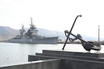
Novorossiysk mountain hike |
|
 The best view of the city, harbour and bay must come from one of the mountains surrounding the bay so that is today's goal. The best view of the city, harbour and bay must come from one of the mountains surrounding the bay so that is today's goal.
A walk past the harbour and the SGS office in north-estern direction with the challenge to find the track without map or my usual gadgets!
 Off course being so close to a harbour my old navigation skills came back fresh in my mind and the fact that there were no trees on the mountain made it fairly easy to find the trail I had in mind. Off course being so close to a harbour my old navigation skills came back fresh in my mind and the fact that there were no trees on the mountain made it fairly easy to find the trail I had in mind.  The huge excavations that I found in the mountain area was a surprise but I did get what I was looking for: A panoramic view of the bay, harbour and city! Click on read more below to find the panorama picture. The huge excavations that I found in the mountain area was a surprise but I did get what I was looking for: A panoramic view of the bay, harbour and city! Click on read more below to find the panorama picture.
Read more ...
|
|
Novorossiysk city hike |
|
 To explore the city of Novorrossiysk and the Black Sea coast I decided to hike from my hotel through the city centre and then along the coast. To explore the city of Novorrossiysk and the Black Sea coast I decided to hike from my hotel through the city centre and then along the coast.
The first things noticed are the braod roads, many trees and parks found in the city center. Along the harbour and the bay in the city there is a broad boulevard with lawns and trees that make walking pleasant.
 As there were many locations where local support was required during the Go-Live phase most of our implementation team members were in Russia. For me it was a welcome change from the more or less boring but challenging work of testing a new software version. As there were many locations where local support was required during the Go-Live phase most of our implementation team members were in Russia. For me it was a welcome change from the more or less boring but challenging work of testing a new software version.  Although I had not been involved in the hard work done to get to this stage I did feel proud to play a little part in this new milestone achieved within our company. Although I had not been involved in the hard work done to get to this stage I did feel proud to play a little part in this new milestone achieved within our company.
Read more ...
|
|
Traveling to Tuapse |
|
 With a stop in Moscow I flew to Krasnodar in Russia to travel by car to Tuapse on he Black Sea cost. With a stop in Moscow I flew to Krasnodar in Russia to travel by car to Tuapse on he Black Sea cost.
A 2 week trip to support my colleagues that had completed the difficult job of the eBusiness Suite implementation in our Russian offices.
 As there were many locations where local support was required during the Go-Live phase most of our implementation team members were in Russia. For me it was a welcome change from the more or less boring but challenging work of testing a new software version. As there were many locations where local support was required during the Go-Live phase most of our implementation team members were in Russia. For me it was a welcome change from the more or less boring but challenging work of testing a new software version.  Although I had not been involved in the hard work done to get to this stage I did feel proud to play a little part in this new milestone achieved within our company. Although I had not been involved in the hard work done to get to this stage I did feel proud to play a little part in this new milestone achieved within our company.
Read more ...
|
|
My Horizon |
|
 Ever since I started to live in my new apartment in De Kroon (The Crown) downtown The Hague I have wanted to share my view from the living room with friends and family. Ever since I started to live in my new apartment in De Kroon (The Crown) downtown The Hague I have wanted to share my view from the living room with friends and family.
Since October 15th, 2012, I have a new page on my website called 'My Horizon'.
Basically this page is a panorama picture taken with 10 picture from my wondows and combined in 1 background picture as I see my horizon. I have taken en collected detailed pictures of some of the buildings and sites I see on my horizon and if you click on the red text markers you will see a close up.
Enjoy my view!

View My Horizon ...
|
|
Palm Jumeirah to Hatta and Fujairah |
|
 The day started with a walk on the Crescent of the Palm Jumeirah, the only Palm Islands project that was completed in the United Arab Emirates. The day started with a walk on the Crescent of the Palm Jumeirah, the only Palm Islands project that was completed in the United Arab Emirates.
With my colleagues Jean-Charles and Alexey I drove to the parking in front of the Atlantis hotel and from there we walked and drove on the 11 km long Crescent.
 After we brought Jean-Charles back to his hotel Alexey and I drove to Hatta in the desert about 100 km east-south-east of Dubai, close to the Oman border. We walked around the old watch tower and visited the heritage village with the old Hatta Fort. From Hatta we drove through the mountains to the beach of Fujairah on the Gulf of Oman and back to Dubai again. After we brought Jean-Charles back to his hotel Alexey and I drove to Hatta in the desert about 100 km east-south-east of Dubai, close to the Oman border. We walked around the old watch tower and visited the heritage village with the old Hatta Fort. From Hatta we drove through the mountains to the beach of Fujairah on the Gulf of Oman and back to Dubai again.
Read more ...
|
|
East coast: Dibba and Khor Fakkan |
February 24, 2012 |
 With Dubai on the border of the Arabian Gulf in the west of the Emirates I also wanted to visit cities in the east on the coast of the Gulf of Oman. I decided to start in Dibba in the north and then travel south following the coastline. The main difference between the west- and east coast are the flat desert lands in the west and the Al Hajar mountains in the east. With Dubai on the border of the Arabian Gulf in the west of the Emirates I also wanted to visit cities in the east on the coast of the Gulf of Oman. I decided to start in Dibba in the north and then travel south following the coastline. The main difference between the west- and east coast are the flat desert lands in the west and the Al Hajar mountains in the east.
 Dibba seemed to be a sleeping town but I could have been mislead by the fact that it was Friday; the muslim prayer day. Dibba seemed to be a sleeping town but I could have been mislead by the fact that it was Friday; the muslim prayer day.
In Khor Fakkan (later in the day) there were quite a number of people on the street and on the beaches when I made a great walk in lovely weather.
Read more ...
|
|
Jumeirah and Umm Suqeim beaches |
February 18, 2012 |
 After yesterday there was still quite a bit of wind ad sand in the air but I decided to stick to my pland and walk south from the hotel via de beaches of Jumeirah and Umm Suqeim as much as possible. After yesterday there was still quite a bit of wind ad sand in the air but I decided to stick to my pland and walk south from the hotel via de beaches of Jumeirah and Umm Suqeim as much as possible.
 I had two goals for this hike: Burj Al Arab and Madinat Jumeirah. I had two goals for this hike: Burj Al Arab and Madinat Jumeirah.
The first being the worlds first 7-star luxury hotel that is shown as a significant landmark on so many (tourist) information you find about Dubai.
Madinat Jumeirah is a holiday resort, shopping mall and souk build in faux-Arabian style as a self contained city with small canals.
Read more ...
|
|
Deira to Ras Al Khaimah |
February 17, 2012 |
 Traveling north on the coast from Dubai I first came trough Deira with it´s unfinished Palm Islands and then in Port Khalid in Sharjah I came across this dock on the side of the road and watched Dhow´s being loaded. Traveling north on the coast from Dubai I first came trough Deira with it´s unfinished Palm Islands and then in Port Khalid in Sharjah I came across this dock on the side of the road and watched Dhow´s being loaded.
 After Sharjah the trip continued to Umm Al Quwain where I made a walk in the old part of the town. After Sharjah the trip continued to Umm Al Quwain where I made a walk in the old part of the town.
When I left Dubai thre was a sand storm; strong winds from the south (desert) and the sand in the air made the visibility unclear and not pleasnt to be outside. I was lucky having planned this trip today as the further north I came less sand was bothering me.
Read more ...
|
|
Wafi City and Creek Side Park |
February 11, 2012 |
 Although I never intended it to be like that this website starts to show a selection of shopping malls as my walks through the city do take me to and past these places. Although I never intended it to be like that this website starts to show a selection of shopping malls as my walks through the city do take me to and past these places.
 Today the goal of my city hike was to go to the ´Creek Side Park´ on the south side of the Dubai Creek. Today the goal of my city hike was to go to the ´Creek Side Park´ on the south side of the Dubai Creek.
I had to zig-zag through city and included the ´Egyption´ Wafi City Mall in the trip to get there.
Read more ...
|
|
Winchester Apartment Hotel |
February 10, 2012 |
 After my return from Dammam I took a few pictures to show where I am living during my stay in Dubai. After my return from Dammam I took a few pictures to show where I am living during my stay in Dubai.
The hotel is located on Kuwait road on the south side of Bur Dubai, the old town area south of the Dubai Creek.
|
|
Dammam CRP |
February 5-9, 2012 |
 My first visit on land to Saudi Arabia. My first visit on land to Saudi Arabia.
In the past I have been to sea island crude oil loading berths in the Arabian Gulf and joined the ms Ficus in Jeddah on the Red Sea but I never really visited the country.
On february 3rd I flew from Dubai to Dammam for our first training and review session to implement the standard order management software used by the company.
More about Dammam and Saudi Arabia will follow after I move there for the next part of the project on March 23rd.
|
|
Bur Dubai and Dubai Creek |
January 21, 2012 |
 After the modern downtown Dubai around the Burj Khalifa and the Dubai Mall it is time to explore the area around my apartment hotel in Bur Dubai. After the modern downtown Dubai around the Burj Khalifa and the Dubai Mall it is time to explore the area around my apartment hotel in Bur Dubai.
Bur Dubai is located on the south side of the Dubai Creek. It takes me about 20 minutes walking to reach the creek and then I can stroll through the Old Souk, along the restaurant Dows and enjoy the activity on the water and the people on the waterfront.
 An Abra will take you across the Creek to the Souks of Deira with places known as the Gold Souk, the Parfumes Souk, the Spice Souk and not to forget the Fish, Meat and Vegetable Souk. An Abra will take you across the Creek to the Souks of Deira with places known as the Gold Souk, the Parfumes Souk, the Spice Souk and not to forget the Fish, Meat and Vegetable Souk.
Read more ...
|
|
Burj Khalifa and Dubai Mall |
January 20, 2012 |
 As I needed to do some personal shopping I decided to do this at the Dubai Mall and make that my first discovery tour of Dubai. As I needed to do some personal shopping I decided to do this at the Dubai Mall and make that my first discovery tour of Dubai.
 Even for an experienced traveler like me this mall was nothing like anything I have ever seen before. Shopping, food, entertainment, waterfall, fountains and tourist attractions (Aquarium, Ice-Skating ring, KidZania). Even for an experienced traveler like me this mall was nothing like anything I have ever seen before. Shopping, food, entertainment, waterfall, fountains and tourist attractions (Aquarium, Ice-Skating ring, KidZania).
Read more ...
|
|
Burj Khalifa |
January 18, 2012 |
 Burj Khalifa is the highest building in the world: 828 meters from the ground floor to the top of the mast. I visited the building with my team members. Burj Khalifa is the highest building in the world: 828 meters from the ground floor to the top of the mast. I visited the building with my team members.
With more than 160 stories it is a bit disappointing that the observation desk is 'only' on the 124th floor, 452 metres above ground level!
 We reached that hight by a single elevator ride of 1 minute and 15 seconds! We reached that hight by a single elevator ride of 1 minute and 15 seconds!
Once outside on the obsevation desk there is still a building of more than 40 stories above you ...!
 After visting the tower we went to Sammach, a fish restaurant in Souk Al Bahar. After visting the tower we went to Sammach, a fish restaurant in Souk Al Bahar.
Good food and a perfect view of the water fountains between Burj Khalifa, Dubai Mall and the Souk. The fountains were operated regularly during our dinner because of the ongoing Dubai Shopping Festival.
|
|